
Mont Joigny and Mont Pellat
Starting point: Col du Granier Difficulty: 1 Ascent: 700 m Time: 4 hrs Quality: ***
This walk is a walk of superlatives - it passes through a pastoral paradise, traverses a superb ridge, and boasts some of the best views in the area. As quite a lot of it is in forest and away from the glare of the limestone cliffs, it is also particularly suitable for excessively hot days. It starts from the col du Granier, makes its way up Mont Joigny, and then follows the ridge overlooking Chambéry round to Mont Pellat, before descending via the Col des Fontanettes to the tiny hamlet of Grand Garroz. From here, an easy stroll surrounded by some idyllic hayfields returns one back to the start (map). The walk is mainly easy going. It has one minor scrambly descent and a couple of short sections with mild exposure, but that shouldn't be allowed to put anybody off.
Park at the Col du Granier, where there is plenty of parking (1130 m, grid ref. UTM 31T 772728 504038) just to the west of the road junction. The track goes off from behind some public lavatories opposite the restaurant, and is reassuringly signposted to Mont Joigny. It initially passes through meadows with interludes of forest for some ten minutes or so, until a sign-posted junction at Les Ravines directs us along a smaller track ascending to the north. It has a junction after a few minutes - we select the one going straight on, following the yellow way-markings. Half an hour of steady ascent reaches the ridge at 1490 m where another signpost indicates Mont Joigny is to the left. From here, our route follows the ridge all way round the le Grand Carroz amphitheatre, and is magnificent walking every step of the way.
The path gently ascends through beech woods for a few minutes before the views start opening out towards Chambéry and the Bauges Massif. Some ten minutes after reaching the ridge, a small grassy promontory is reached, some 100 metres long. This is not yet the summit, but it is a good place for breakfast as it will probably be less busy than the true summit, and there is a superb view of Mont Blanc looming over the Bauges. The true summit is reached after a further five minutes or so, and is marked with a signpost. It has impressive views into the cirque below, where le Grand Carroz can be seen nestling within its sea of hayfields.
From the summit the path drops steeply through some small crags, reaching a col in the forest 15 minutes later. It then rises up gently to soon arrive at Pointe de la Gorgeat, a belvédère perched high on the northern most cliffs overlooking Chambéry and Lac d'Aiguebelette. Truely an impressive place. This is the north-east extremity of our walk, and we now follow the ridge west towards Mont Pellat. It immediately drops fairly steeply down to the col de la Drière 180 m below. At one point there is a short slither down some rocks and some mild exposure, but that is the nearest thing to any difficulty. Looking back, one can catch a view of the cliffs below Pointe de la Gorgeat, whilst in front are views of the equally impressive cliffs below Mont Pellat. On the way down we pass a path coming up from the left.
From the col the path works its way up through the wooded southern flanks of the hill back to the ridge. As with Mont Joigny there is a false grassy summit before the true summit is reached. This is the perfect place for a leisurely lunch on a sunny day, with unbelievable views in all directions.
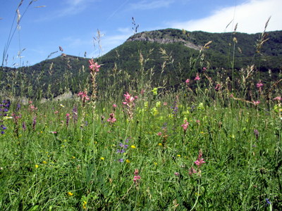
Beyond the summit, the path turns back towards the south along a narrow ridge overlooking the valley separating it from Mont Outhéran. This is a lovely section to walk, albeit with minor exposure for a couple of minutes. Unfortunately, this section is all too short. The path soon re-enters the beech woods, and descends gently to Col des Fontanettes, where our way to le Grand Carroz is signposted to the left. The path morphs into a track after 10 minutes, and then enters a meadow. When we came past in late June the grass was still uncut, and it was one of the most beautiful meadows we have ever seen, with an incredible diversity of flowers. Continuing through the meadow, we pass through le Grand Carroz, a small hamlet of mainly traditional buildings in an idyllic location, following the yellow signposted Tour de Chartreuse.
Beyond the hamlet, the route first descends into a valley, crossing a small stream before climbing out of the valley through beech woods and meadows. Some 35 minutes from the hamlet, it goes round a sharp bend at the top of a hayfield where there is a junction with a path signposted Col de la Gorgeat going off to the left. It is worth while making a short detour here to see an impressive 50 cm diameter fossil ammonite exposed in some steeply dipping rocks some 30 metres up this path. After admiring this, return to the main path and continue back towards the col du Granier.
After a few minutes we enter an extensive meadow, and soon pass through a few ancient barns, the Granges de Joigny, some of which have been converted to basic housing. This is a wonderful spot with one of the most sublime views in Chartreuse, looking straight down the internal valley towards Chamechaude, and including Grande Sure, Grand Som, Dent de Crolles, Lances de Malissard, Le Truc, and Granier.
From here, the track continues easily, past where we started our ascent of Mont Joigny, and we arrive back at the car ten minutes later.