
Ascent from the col de la Charmette
Starting point: Charmant Som top car park Difficulty: 1 Ascent: 600 m Time: 4 hrs Quality: **
This walk is a circular walk that ascends Charmant Som from the col de Charmette, but as it is a long way round to drive to the logical start, this variation actually starts from the car park at the top of the Charmant Som road, and initially descends to the col de la Charmette. From there the path ascends Charmant Som via the south ridge, and returns to the car park through the pastures above the fromagèrie (map). The ascent of Charmant Som is also covered by the walk from Valombré, but this is shorter, allowing more time to savour its delights.
Park at the top of the road from the Col de Porte towards Charmant Som, where there is a restaurant and a fromagèrie. Return down the road for about 700 metres to where a track takes off to the right, with a signpost pointing to the col de la Charmette. Follow this track meandering through the pastures for some 10 minutes, and then take a path leading into the forest on the right. The next half an hour is on a pleasant path zig-zagging down the flanks of the valley. A forest track is then intercepted and followed for ten minutes to the Col de la Charmette (1260 m), reached within an hour or so of pleasant walking from leaving the car.
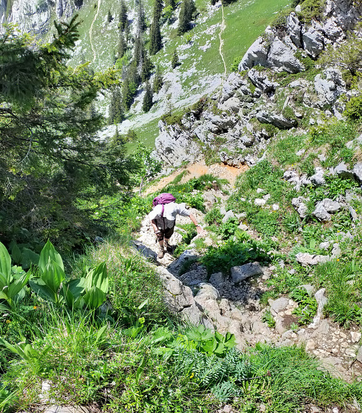
This is the meeting point for a number of paths, so it is just as well as to get your bearings. Our path takes off on the immediate right of where we joined, and is not marked on the prominent signpost. After a quarter an hour a junction is reached with the Chemin de la Cochette joining from the right. The track soon morphs into a path, and a few minutes later, starts to follow a stream bed in a ravine which follows the line of a geological strike-slip fault, passing some water troughs en route.
Some twenty minutes after leaving the Chemin de la Couchette, the path leaves the forest to enter a lovely little valley, surrounded on three sides by cliffs, and wanders up the pasture to the left, where we often see chamois (Rupicapra rupicapra cartusiana). Follow the line of the dry valley up up to the end, where you will find yourself on the north ridge of Charmant Som, facing fantastic views of the Grand Som and the monastery. Turn right, and the path meanders on or near the narrow ridge for a quarter of an hour through a floral wonderland, before descending gently into a pasture. This leads towards the western cirque, which the main path descends into before rising up to a terrace between cliffs on the far side. There is, however, a smaller path which branches off to the left, initially over some limestone, towards the head of the fault valley, which we take.
Once round the head of the valley, the path rises steeply, and we abruptly arrive at the summit (1867 m), some three hours after leaving the car. After the solitary ascent, the crowds on the summit will come as a somewhat rude shock. At weekends, it's a major exercise to negotiate one's way round the vast groups who are having photographs taken to celebrate their successful 200 m ascent from the car park.
One can find a quiet corner, however, and there are worse spots to have lunch, which you will probably have to share with the alpine choughs. The views are splendid. Chamechaude dominates to the south-east, and with a pair of binoculars you can pick out the traverse through the cliffs from le Jardin. To the north, you can see the monastery nestling beneath the dramatic western cliffs of the Grand Som. By moving along the ridge to the north for a few metres, you can get an impression of the splendid cliffs lying beneath you. To the west, you can see across the col de la Charmette to la Grande Sure.
You can follow the south ridge straight back to the car park, but a better option is to branch off this after 150 metres to follow a path dropping down into the obvious large pasture. At the bottom of the zig-zags, the chalets can be seen to the left, but instead follow an ancient ditch along the top of the southern cliffs of the fault valley, taking in fine views of the area just visited. At the corner of the pasture, follow the path round to the north back towards the car park. Your progress through this pasture will inevitably be observed by a herd of the beautiful native tarine dairy cows. When you have returned to the car park, it is worth popping into the fromagèrie to buy some of their fresh cream and tomme de Savoie cheese. The copper vat in the fromagèrie is a thing of beauty.
All in all, an excellent walk which allows plenty of time to enjoy a beautiful area.