(Click photograph for a larger image)
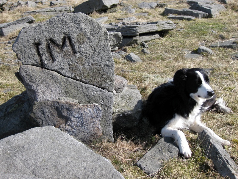
Location: This stone lies 60 m east of New Pasture wall and 470 m north of John Young Gate, overlooking the dry valley.
Latitude: 54.100723 Longitude: -1.968249
NGR: SE 02174 67206
Inscription: IM
This is a 60 cm high stone overlooking the dry valley. It had broken into two pieces, but is currently re-erected. It probably marks the south-east corner of the holding held by Minikin & Co. on the Burnt Ling vein, which appears on the Brailsford survey of 1781. Minikin was not an uncommon name in the area at the time.