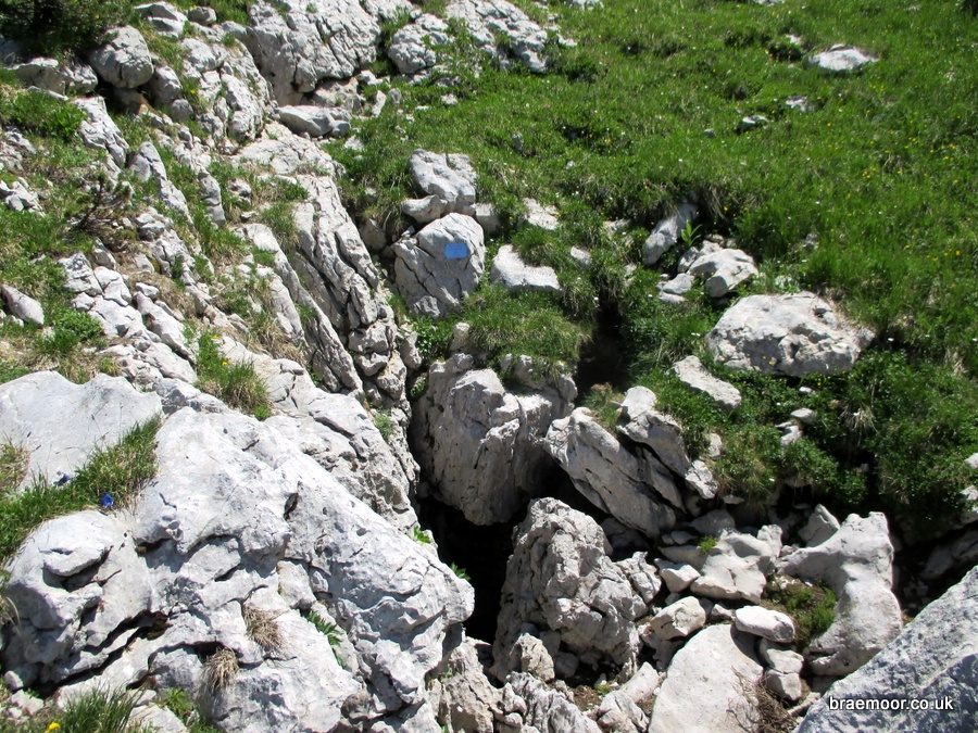
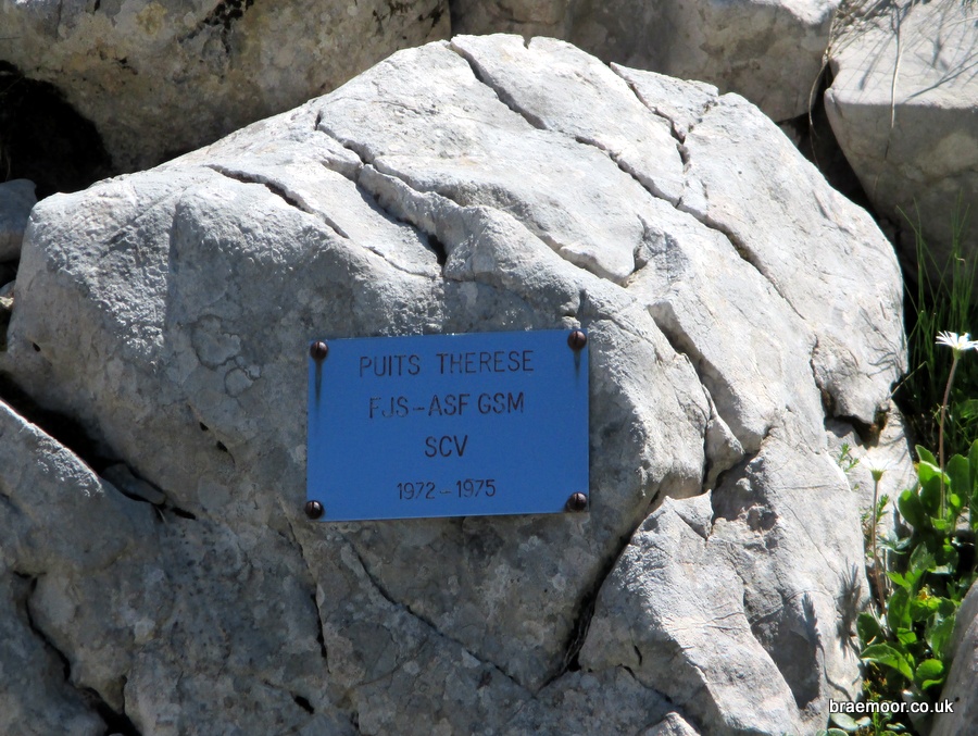
Gouffre Thérèse
Northing: 45.318150° Easting: 5.864574° Altitude: 1,933 m
How to find it
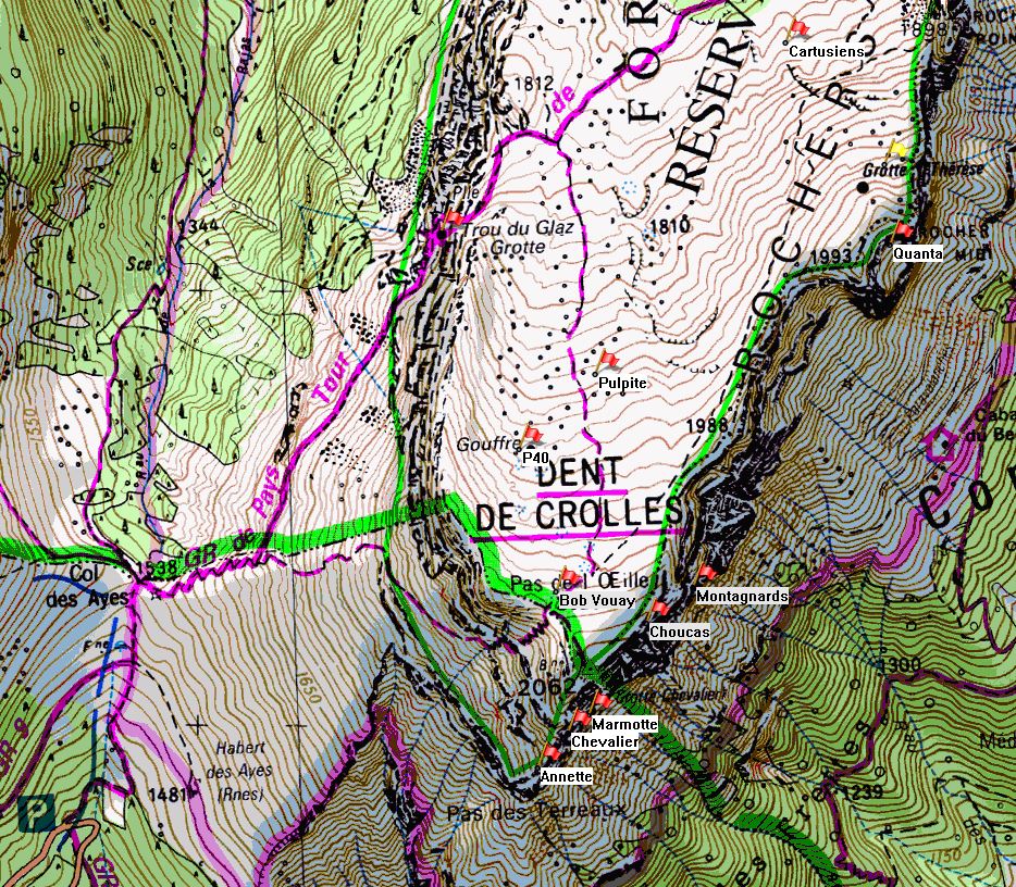
Gouffre Thérèse is located in a shallow valley 130 metres NNE of the summit of the Rocher du Midi. Follow the GR9 from Col du Coq past Trou du Glaz to the plateau. From here, it is most easily found from above by making your way up towards the summit, and following the crête to the Rocher du Midi, but with a GPS it can also be approached from a lower path that makes its way along the eastern flank of the plateau. This can be reached directly from a thin path, not shown on the map, which heads towards the Rocher du Midi from the junction of the summit path and the GR9. Note that the entrance is 70 m north-east of the position indicated on the IGN map.
Further information
Gouffre Thérèse, named after Thérèse Voinson - a member of the original exploration team, was first explored in 1972, and in 1975 it became the second cave on the plateau to be linked into the Réseau de la Dent de Crolles. It is far more of a challenge than P40. Because it descends into the Guiers Mort the through trip is almost twice as deep as that of the P40 - Trou du Glaz, twice as long, and it requires twice the rope. The total traverse is about 2.7 km long, and descends over 20 pitches, with 400 m of abseiling. The through-trip requires a couple of 60 metre ropes, and typically takes about 10 hours. It is characterised by complex route finding, a sequence of deep pitches, and traversing in meanders. It enters the Grotte du Guiers Mort in the Galerie Véronique, and from there the route is waymarked. The route is flood-prone so conditions should be reasonably dry. The normal approach is from the Col du Coq, and the exit is in the Perquelin valley, so attention should be paid to transport logistics.
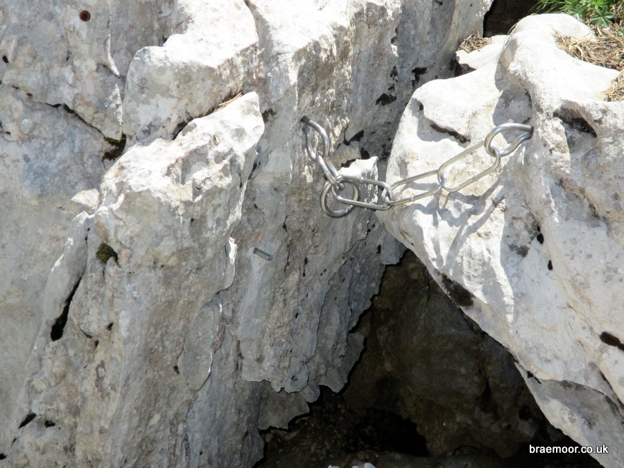
There are a number of detailed descriptions available on the web, but the best and most detailed is that produced by the local rescue organisation, the Spéléo Secours Isère. Progress is mainly made in meanders but, as with many French meanders, there are a number of possible variations, and the one described above has been equipped with traverse lines and belay chains. The description has been loosely translated by the author, and is available here (use at your own risk).