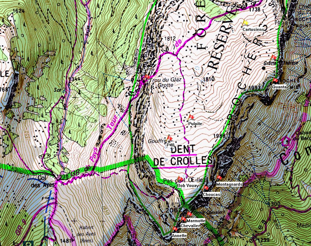
Puits des Cartusiens
Northing: 45.320803° Easting: 5.861758° Altitude: 1,783 m
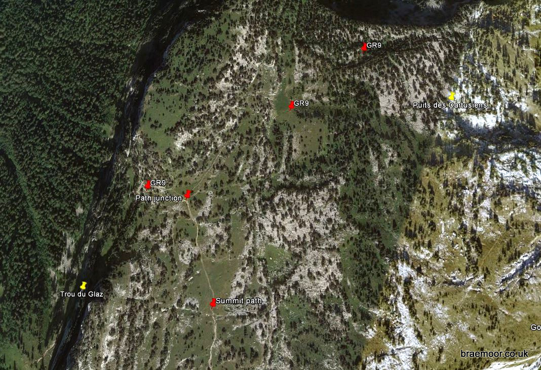
How to find it
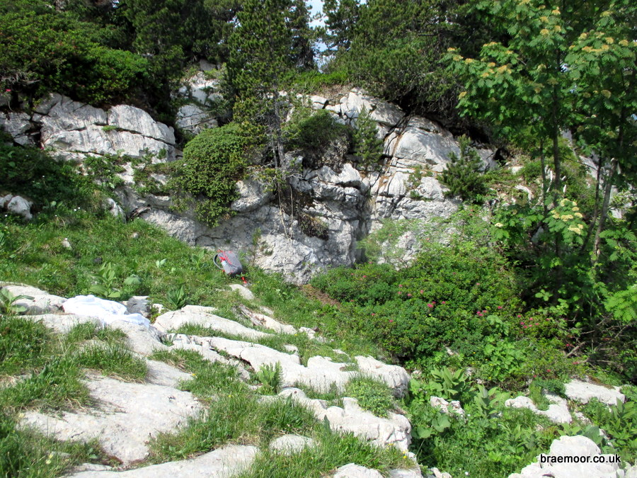
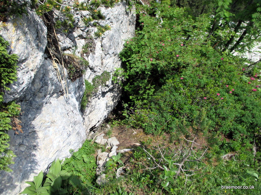
Puits des Cartusiens is not that easy to find. Follow the waymarked GR9 from Col du Coq onto the plateau, and continue past the junction with the summit path for about 700 metres. Look for an old pine by the path which has two 90° bends just above head height, and a large cairn at its foot. About 20 metres past this, go up the slope for about 150 metres. The cave is tucked obscurely under a low cliff with a pavement in front, and may have a belay cord hanging from a tree. A GPS is strongly recommended! One can also find it from the path that traverses under the eastern edge towards the Cheminée du Paradis. The path drops sharply when it descends the same low cliff – follow the shallow valley below the cliff down for about 90 metres to reach the same area of pavement.

Further information
First explored in 1959, Puits des Cartusiens was linked to Grotte du Guiers Mort in 2007, entering at the Galerie du Solitaire. The route is a little vertical – apparently one stays attached to the rope all the way down to -230 m, except for one short blasted meander at -88 m! It is not equipped for pull-throughs, but it is a good candidate for an expedition-style descent, requiring 370 m of rope, 50 hangers, and numerous deviation cords. Reports indicate that it is not flood-prone, but it can get damp – especially on the lower pitches. A good description with cross-section by Jean Philippe Grandcolas and others may be found here.
There is a full account of the cave and its exploration in Spéléo Magazine 60 (2007) by Christian Hubert and Frédéric Pétrot that includes some impressive photographs and an updated large scale survey of the northern half of the system, available on bona fide request. The exploration was also reported in Spelunca Magazine 108 December 2007.